Monday 31 August 2020

10 California Engineering Surveying Studying Tips


1. Buy a graphing calculator 

A graphing calculator will save you so much time on the California Surveying Exam (CSE) in converting from Degrees Minutes Seconds to a decimal form of Degrees. The calculator requirements for this exam are different than others, so be sure to check them and invest wisely! 

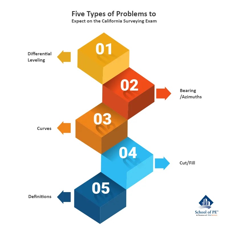
2. Focus on the curves 

Vertical- and horizontal-curve questions are the most important thing to study. They come up often on the exam and can be tricky. Being able to identify locations in the problem statement/diagram as terms in the curve equations will be key to your success. 

3. Don't underestimate the difficulty of "scale" questions 

"Scaling" may seem like an easy concept, but trust me, it can be harder than it seems in the pressure of an exam. There are several ways this can go: a scale given in length, and the exam asking about an area; two scales being compared and needing to know which is "larger"; needing to know what scale to use based on a given a distance and the size of a paper; or asking for a real distance given the measured distance and scale factor. Be sure to have experience with each of these! 

4. Memorize conversions 

I don't think I'll ever forget the conversion from 1 square foot to 1 acre: 43560! Memorize some key conversions like this to save time on the exam. Also, have them written somewhere in case the exam stress makes you want to triple check! 

5. Obtain a "surveying" dictionary 

I really think this was a lifesaver for me on the exam when there were definition questions-and trust me there will be! With different types of maps, surveying techniques, equipment, etc., the dictionary is your friend on this exam. 

6. Do as many practice problems as you can get your hands on 

I can't say this enough, but for this exam, in particular, practice, practice, practice! 

7. Don't get overwhelmed by big words like "photogrammetry" 

The CSE really focuses on basic surveying techniques, geometry, and conversions. Your time is better spent doing practice problems, getting familiar with terms and equations, and memorizing definitions than getting swept up in fancy technology. Know about it, but don't dwell on it. 

8. Zeniths and Bearings will be in (almost) every question-make sure you know the difference and are comfortable with them 

Zeniths and Bearings are a fancy way of stating the slope of a line. If you think this exam is about anything other than determining the angles and distances of objects and curves, you're mistaken. Be able to identify these problems, be comfortable with them, and you'll go far with this exam.

9. Have area formulas handy 

These can be a pain to memorize (and honestly probably too much to hold in your brain) while also memorizing terms and formulas. Still, you should have area formulas handy to quickly skim and determine the best formula to use. 

10. Get into it! 

A LOT of engineers seem to think this is the "least interesting" exam or wonder why certain types of civil engineers need to take it. Trust me, this whole studying and exam-taking process will be a lot easier and more enjoyable if you get rid of that little voice in your head and find this stuff interesting!
About the Author: Erin E. Kelly

Ms. Kelly is an experienced structural engineer with a focus on seismic risk. She has extensive experience in structural failure investigations, seismic structural design, and seismic risk assessments. Through the School of P.E., she has taught a 32-hour course for the California Seismic P.E. Exam, authored several blog posts, and contributed to other review products. She has a Bachelor of Science in Civil Engineering from Johns Hopkins University and a Masters of Engineering in Structural Engineering from Lehigh University.

Monday 24 August 2020

Does Passing the CA Surveying Exam Make You a Licensed Surveyor?

The short answer is no. Despite passing a licensing exam commonly referred to as the "surveying exam," you are only taking this exam to complete civil engineering licensure, not a surveying licensure. 

This applies to the current day, but it's good to know that civil engineers registered before January 1, 1982 are, for all intents and purposes, considered licensed surveyors. 

So, what can you do? You can: 

  •   Create and use topographic maps 
  •   Set construction stakes after control points are established 
  •   Create contour surveys using photogrammetry 
  •   Become a city engineer 
  •   Create a tentative map (a preliminary subdivision or parcel map) 
  •   Prepare civil plans 
  •   Use ALTA (American Land Title Surveys) to create grading plans 

What can you not do? You cannot: 

  •   Set and relocate monuments or control points 
  •   Re-establish benchmark elevations 
  •   Replace lost corners 
  •   Prepare legal descriptions 
  •   Prepare parcel or subdivision maps 
  •   Prepare boundary/property surveys 
  •   Perform boundary line adjustments 
  •   Perform geodetic surveying 
  •   Replace lost corners 
  •   Establish easements 
  •   Create right-of-way maps 

These "cans" and "cannots" are outlined in several acts, the two most predominant being the Subdivision Map Act and the Civil Engineers Act. For the Civil Engineers Act, Article 3 outlines the "authority to offer to practice or procure land surveying." This is the most important section of the Act when it comes to what you can and cannot do. 

Because of all of these restrictions, it is frequently questioned by many civil engineers why this test is required or worthwhile. My answer is that you, as a civil engineer, need to be able to interpret surveying documents that are presented to you. In design structural engineering, in particular, you'll be presented with documents from several disciplines (civil, landscaping, architectural, electrical, mechanical, etc.) and each of those documents will influence your design. If you misinterpret surveying information on the civil grading plans, for example, your design may not have factored in some critical loading information. 

While passing this exam doesn't grant you all the rights of a licensed surveyor, it is important for us to recognize the role that we play, and the importance of competency on the subject. 

School of PE offers comprehensive exam review courses for the CA Seismic and CA Surveying exams. Visit our website to register for a prep class that best fits your schedule.
About the Author: Erin E. Kelly

Ms. Kelly is an experienced structural engineer with a focus on seismic risk. She has extensive experience in structural failure investigations, seismic structural design, and seismic risk assessments. Through the School of P.E., she has taught a 32-hour course for the California Seismic P.E. Exam, authored several blog posts, and contributed to other review products. She has a Bachelor of Science in Civil Engineering from Johns Hopkins University and a Masters of Engineering in Structural Engineering from Lehigh University.

Monday 17 August 2020

Five Types of Problems to Expect on the California Surveying Exam


1. Differential Leveling 

Differential leveling problems are big on the exam, but luckily really come down to two main formulas, with very few variables. Make sure you know the definitions of backsight and foresight and these will be a breeze. 

Related: Stadia problems are similar but involve the inclined equipment and a lot more geometry when sorting out the angles. 

2. Bearings/Azimuths 

A bearing is a measurement of an angle within a quadrant, relative to the north and south axes. An azimuth is a measurement of an angle relative to the north axis (up to 360 degrees). These two terms are guaranteed to come up on the exam, either as standalone questions or part of a larger problem. 

Related: Make sure you have a graphing calculator to help convert Degrees Minutes Seconds to Degrees! 

3. Curves 

Horizontal and vertical curves are, from my experience, the largest topic on the exam. The best thing you can do for yourself is to practice these questions until you feel absolutely confident. It will also help to either tab your notes or make a cheat sheet with all the useful formulas. 

Five Types of Problems to Expect on the California Surveying Exam

4. Cut/Fill 

Cut and fill questions were, honestly, the hardest for me. While it may seem simple, these problems combine several concepts, sign conventions (+/-), area formulas, reading charts, and knowing many definitions. 

Related: Along with cut and fill diagrams, don't forget to study up on mass diagrams, borrow pits, and shrinkage vs. swell. 

5. Definitions 

Definitions will make up a major portion of the exam, and my #1 tip is to take a surveying dictionary with you into the exam. This will help with all the terms and make you feel confident in your answers. The definitions will often be focused on types of maps, surveying techniques, or equipment. 

School of PE offers comprehensive exam review courses for the CA Seismic and CA Surveying exams. Visit our website to register for a prep class that best fits your schedule.
About the Author: Erin E. Kelly

Ms. Kelly is an experienced structural engineer with a focus on seismic risk. She has extensive experience in structural failure investigations, seismic structural design, and seismic risk assessments. Through the School of P.E., she has taught a 32-hour course for the California Seismic P.E. Exam, authored several blog posts, and contributed to other review products. She has a Bachelor of Science in Civil Engineering from Johns Hopkins University and a Masters of Engineering in Structural Engineering from Lehigh University.

Sunday 9 August 2020

Errors in Surveying: How to Identify and Calculate for the CA Surveying Exam

The data mapped in surveying can be used for many purposes, from defining boundaries in legal documents to determining the best route to run utilities or construct a road. With all of these implications, accuracy in surveying is so important. However, given the varying terrains and conditions for it, it's no surprise that accuracy can be hard to ensure in the field. 

The two main styles of surveying covered on this exam are stationing with tapes and using a total station to create a traverse. In this blog post, we'll cover errors for both methods. 

1. Stationing Errors

When stationing with a tape, each tape will be standardized to a certain temperature, tension, and length. You'll learn the correction formulas in the course, but here are some rules of thumb to remember: 

For temperature, if the temperature is higher than the standard, the measured distance will be shorter than the actual distance. If not otherwise noted, the standard temperature is usually 68 degrees Fahrenheit. 

For tension, if the tension is higher than the standard tension, the measured distance will be shorter than the actual distance. 

For length, if the tape is found to be longer than the nominal length, the measured distance will be shorter than the actual distance. If not otherwise noted, the standard length is 100 feet. 

There are two other corrections that you should also be aware of, and those are for sag correction (also related to tension) and elevation correction if the measurements are being taken at a high altitude. 

2. Closed Traverse Errors

When conducting a survey using a total station, the path that the surveyor travels is called a traverse. A closed traverse is when the surveyor starts and ends in the same place. If the surveyor intends to do this, but the start and end points are slightly different, you have an error that must be accommodated for. This is called a misclosure error

To adjust for this, consider the X and Y components of the misclosure error, and then apply those proportionally to each leg. So, if one leg is 50% of the total traverse, you would apply half the error in X and half the error in Y to the end point of that leg. Note that X and Y are handled separately for this. 

In addition to linear misclosure, angular misclosure must be considered as well. The sum of interior angles of a closed traverse should be 180 degrees * (n-2), where n equals the number of nodes or sides. The sum of the exterior angle should be 180 degrees * (n+2). If the sum of the measured angles (interior or exterior) does not match the result of these equations, the angles will need to be adjusted. One thing to note is that all angles are considered equally, so the misclosure adjustment is divided evenly to each angle, and not applied proportionally like the length adjustments are. 

School of PE offers comprehensive exam review courses for the CA Seismic and CA Surveying exams. Visit our website to register for a prep class that best fits your schedule.
About the Author: Erin E. Kelly

Ms. Kelly is an experienced structural engineer with a focus on seismic risk. She has extensive experience in structural failure investigations, seismic structural design, and seismic risk assessments. Through the School of P.E., she has taught a 32-hour course for the California Seismic P.E. Exam, authored several blog posts, and contributed to other review products. She has a Bachelor of Science in Civil Engineering from Johns Hopkins University and a Masters of Engineering in Structural Engineering from Lehigh University.

Monday 3 August 2020

Four Strategies for Tackling Scale Problems on the CA Surveying Exam


1. Know the difference between a large scale and a small scale 

I'll just state this upfront: 1/10 is a larger scale than 1/100. Write that down somewhere, so you never get confused again! The worst part of this exam for me was memorizing conventions like that. This will come up both directly and indirectly in questions. For example, maybe you've determined that the scale required to fit a map on a sheet of paper is 1/44 and the problem asks for the largest scale that can be used, rounded to the nearest 10. The answer would be 1/50, because 1/40 would be too large and 1/60 would be too small. 

2. Study the units in the problem statement and the solution 

A very common "trick" on the exam is to give you a linear scale (so 1:10), and then ask for the measurement of a rectangular area. You'll have to apply the scale factor twice because the units considered are changing from linear to square. For example, if the rectangle is 2" x 3" on the paper, the area isn't just 6 square inches *10 (=60), it's 2*10 x 3*10 = 600. This can definitely get you if you're moving too quickly on the exam, so look out for these. 

3. Notice when units are missing

As in the example above, the scale is given as 1:10. When the units are not given in a scale, you can assume that the units are the same. For example, 1 inch = 10 inches, 1 mile = 10 miles. Sometimes the problem statement can be written in a misleading way, so make sure to recognize when the units are missing. 

Strategies for Tackling Scale Problems on CA Surveying Exam

4. Know what "scale factor" means

You'll sometimes see a problem state, "the scale factor is x" and the measured distance is y, what is the real distance? For me, it can be tricky to remember if you're supposed to multiply or divide by the scale factor, so jot down this formula on your cheat sheet: real distance = measured distance *x 

School of PE offers comprehensive exam review courses for the CA Seismic and CA Surveying exams. Visit our website to register for a prep class that best fits your schedule. 
About the Author: Erin E. Kelly

Ms. Kelly is an experienced structural engineer with a focus on seismic risk. She has extensive experience in structural failure investigations, seismic structural design, and seismic risk assessments. Through the School of P.E., she has taught a 32-hour course for the California Seismic P.E. Exam, authored several blog posts, and contributed to other review products. She has a Bachelor of Science in Civil Engineering from Johns Hopkins University and a Masters of Engineering in Structural Engineering from Lehigh University.